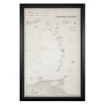
Chart of the Caribbean Islands by James Imray & Son, 1866
|
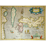
M-11579 - JAPAN & KOREA - Hondius, c. 1606
|
M-13974 - Early Map depicting Virginia to Florida - Hondius, c. 1613
|
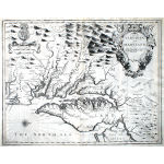
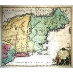
M-13973 - Map of Virginia & Maryland, Speed, c. 1676
|
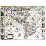
M-13904 - Cornerstone map of the Americas, c. 1644 Blaeu - Cartes a Figures
|
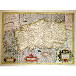
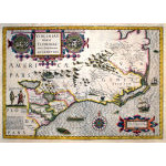
M-13196 - Map of Turkey and Greece, c 1623 - Mercator-Hondius
|
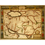
M-12901 - John Speed Map of Persia, c. 1626
|
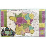
M-12639 - Large separately issued map of France by Hermann Moll c. 1715
|
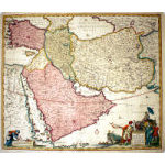
M-12633 - Perrsia, Armenia, Turkey & Arabia in the 1730's
|
M-12215 - Map of New England and New York, c. 1724
|
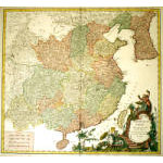
M-11566 - Map of China and Korea by de Vaugondy, c. 1751
|
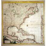
M-10821 - North America - French and Indian War Era
|
| |
|
|